Turismo de Galicia

-
Things to do
Way of St. James
Nature
Culture and heritage
Beaches and coast
Tourist trails
- Top ten: Ten unrivalled destinations
- The route of the camellia
- Tourist routes
- Pathways for discovering a country
- Walks to fall in love with
- Scenery at the wheel
- EuroVelo Galicia
- Beyond the Sunset
Gastronomy
Health tourism
PROMOTIONS TO ENJOY NOW
Cultural agenda
Will happen... View all
- Places to visit
-
Plan your trip
Build your journey
Practical information


-
A miña viaxe
A MIÑA VIAXE
- Compartir
- Correo
- Imprimir

Description
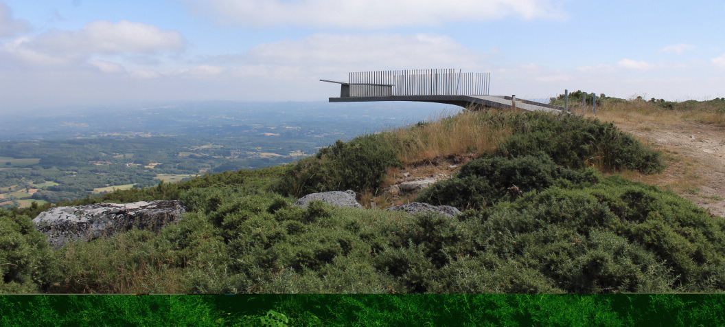
The 952-metre high Cima do Farelo overlooks the route from Agolada to Antas de Ulla, and was historically used to monitor movements between the counties of Deza (Pontevedra) and A Ulloa (Lugo).
In the shadow of the more imposing and better known O Faro range, O Farelo is a medium-height range with views over the splendid rural landscape of central Galicia, with farms interspersed by leafy forests and rivers and rivulets.
O Farelo is special in that it offers a 360o view of all four of Galicia’s provinces. The nearby O Careón mountains lie to the north (Melide), and on a clear day even the O Xistral range is visible. The Ancares mountains in Lugo province can be seen in the distance to the east. The neighbouring O Faro range is to the south and in the west lie the O Candán mountains in the county of Deza.
